|
|
| Course |
CEE 240 Geographic Information Systems in Engineering
Lecture 3 hours; 3 credits; Lab 3 hours
Spring Semester, 2020 (offered at ODU Main campus only)
Call Number:
27850 (Lecture)
21106 (Laboratory: Friday Section)
21666 (Laboratory: Monday Section)
Course Website: http://asellus.cee.odu.edu/gis/
|
| Session |
Spring; January 11 (Sa) through April 27 (M), 2020 |
| Time/Locations |
- Lecture:
- Friday 12:00-12:50 PM at KH 224
- Laboratory: (CEE Computing Laboratory, CEECL, KH 131)
- Friday 1:00-4:50 PM at KH 131
Monday 12:00-3:50 PM at KH 131
** flexible lab scheduling **
(CEECL will be also accessible for your lab exercises
throughout normal weekdays 10:00 AM -- 5:00 PM, plus
software downloads of AutoCAD & ArcGIS for home usage
as well as doing lab sessions over the Internet (via ODU MoVE) --
literally 24/7 access)
|
| Prerequisite |
MATH 212/Calc II and Sophomore standing or higher.
Students are also expected to have a general background in computer.
|
| Instructors |
Jaewan Yoon, Associate Professor, CEE,
KH 130
Phone: (757) 683-4724
Fax: (757) 683-5354
E-mail: <jyoon@odu.edu>
|
| Office Hours |
1:00-3:00 PM T; Open and Extensive,
both in-person and via e-mails.
|
| Lab Assistant Information |
Mason Calvert, CEE
|
|
| |
-
This course is to provide the student of general
knowledges in CAD (Computer-Aided Design /Drafting)
and GIS (Geographic Information System) methodologies
that are widely used in various civil and environmental
engineering fields. Fundamentals and introduction to
emerging CAD/GIS technologies will be discussed.
The first half of this course is devoted
to introducing concepts and essential
techniques in using CAD (Computer-Aided
Design/Drafting). Topics include fundamental
drawing and editing techniques necessary to
creating and plotting/printing 2D drawings.
Application emphasis will be on AutoCAD software;
AutoCAD 2018 available at KH 131 CEE Computing
laboratory (CEECL) and other platforms (at ODU MoVE site or installed
in student's computer) will be used for laboratory exercises.
-
The second half of the course is devoted
to an introduction to the history, fundamental
principles, and current topics in GIS
(Geographic Information System). Topics
include data structures, spatial/temporal
relationships of geographic information,
spatial data acquisition and preparation,
database management, analytical functionalities
in GIS, hardware and software and
engineering application case studies.
ArcGIS Pro available at KH 131
CEECL and other platforms (at ODU MoVE site or installed
in student's computer) will be used for laboratory exercises.
For AutoCAd and ArcGIS access modes and step-by-step software
installation guide, please see "Software for the Class" menu
in the CEE 240 course in BB.
|
| |
-
Student Outcome SO6: An ability to recognize the ongoing need for
additional knowledge, to choose appropriate learning strategies,
and to apply this knowledge:
- SO6-PI1: Capable of recognizing the ongoing need for additional
knowledge and choose an appropriate learning strategy
|
-
- Coursepack for CAD Module
For CAD module, a Coursepack that contains Introduction to CAD materials and
CAD laboratory exercises is used.
Coursepack is made available through Blackboard
at no cost in a PDF file to students
registered to CEE 240 in Spring, 2020.
-
CEE 240 Coursepack & Laboratory Workbook,
2018, Rev. 3, ,
Jaewan Yoon, Department of Civil and Environmental Engineering,
College of Engineering and Technology, Old Dominion University.
**DO NOT** print this coursepack in KH 131
CEE Computing Laboratory -- you *will* be charged with an
applicable printing cost.
- Laboratory Workbook for GIS Module
For GIS module, a laboratory workbook is used
for GIS exercises and assignments.
-
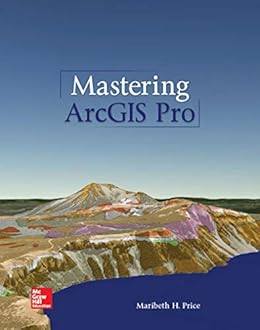
Mastering ArcGIS Pro, 1st Ed.,
Maribeth Price, Mcgraw-Hill College, January 28, 2019,
Loose Leaf Text, ISBN: 1260587371
- A Thumb drive for CAD/GIS Modules
An USB Thumb drive (or Flash drive) with a minimum of
2 GB caqpacity
(or the larger the better) is
required for your CAD & GIS module laboratory works.
Many of CAD/GIS
module lab exercises are cumulative and continued to next lab,
thus you need to save *ALL* your lab files to your thumb drive
and directly work on them from your thumb drive. (Do *NOT* save
your lab files to computer's hard drive -- lab computers are
regularly cleaned up for system maintenance)
Particularly, all your GIS lab exercises require using sample
datasets came along with your GIS Laboratory Workbook.
Before GIS module starts,
download sample datasets to your USB thumb drive by unzipping
"gisclass_Pro1e.zip"
(229 MB).
- Download sample datasets,
"gisclass_Pro1e.zip"
- Unzip "gisclass_Pro1e.zip" by double-clicking it
- Set the extraction folder to
-
<Your USB Thumb drive>\mgisdata
- Click on "Unzip" button
- When completed, click on "Close" button to exit
Make it sure that you always bring your USB Thumb
drive to your laboratory session.
*** Alternatively, you can use your student ODU webdirive (if mounted to H: drive)
to save and access your lab files.
|
| |
 |
Honor System
|
-
The Old Dominion University Honor Code applies to all works
associated with this course.
Academia is all about pride and
respect,
and the Honor Code is the heart of it.
Each lab assignment and module final exam must
have your signature and hand-written "Honor Code pledge"
at the top of the first page that signify your observance on the rules of the
Honor Code.
Any shades of plagiarism or dishonesty will
result in an immediate failure of this course, period.
|
Final Grade Assignment
|
-
| Elements |
Max. Pts. Each |
% |
|
|
|
| CAD/Exam |
100 points |
30% |
| CAD/Lab Assignments |
100 points |
70% |
| |
|
|
| GIS/Exam |
100 points |
30% |
| GIS/Lab Assignments |
100 points |
70% |
|
|
|
| Total |
|
200% |
| Cumulative Total (normalized to 100%) |
|
100% |
|
Letter grades will be based on brackets (see right) out
of the 100% total.
For the 100-90% bracket, equal or
greater than 95% will be A,
then A-. For other brackets, equal or greater than x7 will get +,
between x3 and x0 will get -.
A normalized cumulative total equals
to a 70 percentile or higher will guarantee you a grade of C- or
better. A normalized cumulative total smaller than a 60 percentile will
guarantee you a grade of F.
Noup, what you see is what you get,
grading will *not* be based on the curve.
|
|
| 100%-95% |
A |
| < 95%-90% |
A- |
| < 90%-87% |
B+ |
| < 87%-83% |
B |
| < 83%-80% |
B- |
| < 80%-77% |
C+ |
| < 77%-73% |
C |
| < 73%-70% |
C- |
| < 70%-67% |
D+ |
| < 67%-63% |
D |
| < 63%-60% |
D- |
| < 60% |
F |
|
|
Grading Criteria
|
-
-
Lab assignments (CAD & GIS modules) are idealy
expected at the end of
each laboratory exercise. However, you may (or should)
wish to take more time to
digest/experiment with lab exercise elements.
Since we are on 'flexible scheduling' for lab sessions,
each lab assignment, at latest, should be submitted/uploaded directly
to Blackboard for credits before the beginning
of following Friday's lecture.
After this 1-week cycle, any late lab assignment will
*NOT* be accepted
once Blackboard upload period expired.
-
All your Lab assignments (CAD & GIS modules) will be
saved into a PDF file format (i.e., no hardcopy printout)
and directly submitted/uploaded to Blackboard *before*
following week's Friday Lecture time.
- All CAD module Lab assignments are in the Coursepack,
and due by following Friday, before the lecture. (one week cycle)
- GIS module Lab Assignments and homeworks
will be assigned from GIS Workbook at the end of each Friday lecture,
and due by the following Friday, before the lecture. (one week cycle)
Homeworks must be typed neatly using your favorite wordprocessor.
- Each module Final exam will be a comprehensive exam
that covers all topics discussed in
each module.
Each Final exam will be given in a full class period, and
it will be a closed book, closed note exam.
- Your cumulative grade will be posted on the
latest grade page in class website
as soon as the grading is done per assignment/exam.
- If you believe your exam(s) was incorrectly graded
for some valid reason, please bring it to me with a detailed explanation.
I reserve the right to completely regrade homework(s)/exam(s) that
has been returned. (Regraded result could be either better or worse
than the original grade).
|
|
Attendance Policy
|
-
Due to the nature of closely knitted course topics,
any absence will definitely
have a *VERY* negative effect on the student's learning curve and
overall performance.
If a student must miss a class,
the student is expected to have the
initiative to cover on their own materials that were missed.
Being absent is not an excuse.
The student must meet all course requirements and be present for
assigned laboratory sessions and examinations.
| |
CEE 240 Geographic Information Systems in Engineering
Lecture 3 hours; 3 credits; Lab 3 hours
Spring Semester, 2020 (offered at ODU Main campus only)
Call Number: 27850 (Lecture)/21106 (Lab: Friday)/21666 (Lab: Monday)
** flexible lab scheduling **
Spring; Janunary 11 through April 27, 2020
Today is
|
Important Dates to Remember
|
| CAD Module Final Exam |
Feb 28 (Friday)
12:00-12:50 PM (50 minutes) |
| Spring Break (No Laboratory/Lecture) |
March 9 (Monday) through 14 (Saturday) |
| GIS Module Final Exam |
April 24 (Friday)
12:00-12:50 PM (50 minutes) |
|
| Session |
Date |
Module |
|
Topics |
Read |
| 2 |
Jan 13M |
CAD |
|
No Lab
(Class has not offically started)
|
|
| 1 |
Jan 17F |
CAD |
Lect #1 |
Introduction, Engineering ethics and professionalism,
basic concepts of CAD, coordinate systems,
scale, basic maneuvers, file I/O. Important commands,
variables, and wildcards, coordinate methods.
|
Coursepack |
| 2 |
Jan 17FJan 20M |
CAD |
|
No Lab
(First week of the class & Martin Luther King Day)
|
|
| 3 |
Jan 25F |
CAD |
Lect #2 |
Basic drawing setup, units, limits, snap. Basic drawing
of line, circle, arc, point. Modifying existing drawing entities.
|
Coursepack |
| 4 |
Jan 24FJan 27M |
CAD |
Lab #1 |
Lab exercises for Lecture #1 and #2 topics
|
Coursepack |
| 5 |
Jan 31F |
CAD |
Lect #3 |
Core 'Modify' commands. Entity arraying and mirroring
concepts and basic techniques. Viewing entities. Layer
concepts, and entity attribute manipulation including layer,
linetypes, color, ltscale.
|
Coursepack |
| 6 |
Jan 31FFeb 3M |
CAD |
Lab #2 |
Lab exercises for Lecture #3 topics
|
Coursepack |
| 7 |
Feb 7F |
CAD |
Lect #4 |
Plotting and printing basics. Polyline editing techniques;
pedit/explode.
Polyline entities; divide, measure, solid, boundary and
region (Boolean operation).
Intermediate editing techniques;
Chprop, change and object properties.
|
Coursepack |
| 8 |
Feb 7FFeb 10M |
CAD |
Lab #3 |
Lab exercises for Lecture #4 topics
|
Coursepack |
| 9 |
Feb 14F |
CAD |
Lect #5 |
Construct and measure of drawing entities;
offset, mline, fillet and chamfer.
Text creation and editing techniques.; text, dtext|ddedit and mtext.
|
Coursepack |
| 10 |
Feb 14FFeb 17M |
CAD |
Lab #4 |
Lab exercises for Lecture #5 topics
|
Coursepack |
| 11 |
Feb 21F |
CAD |
Lect #6 |
Block concept. Techniques of creating, editing,
inserting block entities. Manipulation of entity
attributes; techniques to create, edit, update,
extract attributes. Basic hatch pattern and
hatch boundary techniques. Basic projection and view.
Dealing with multiple views.
|
Coursepack |
| 12 |
Feb 21FFeb 24M |
CAD |
Lab #5 |
Lab project for Logo Design
|
Coursepack |
| 13 |
Feb 28F |
CAD |
 |
CAD Module Final Exam
12:00-1:00 PM (1 hour)
|
 |
| 14 |
Feb 28FMar 2M |
GIS |
Lab #0 |
No Laboratory
|
|
|
Session |
Date |
Module |
|
Topics |
Read |
| 15 |
Mar 6F |
GIS |
Lect #1 |
Introduction to GIS; Background historical
development. Essential elements of a GIS.
Spatial data principles. Map and attribute
- their significance in GIS.
|
Lecture Note |
| 16 |
Mar 6F |
GIS |
Lab #1 |
Lab exercises #1
(due by March 20, Friday)
- Chapter 1. What is GIS (Page 25)
- Chapter 2. Mapping GIS Data (Page 60)
- Chapter 5. Managing Vector Data (Page 161)
|
Lab Workbook |
| 17 |
Mar 9M |
GIS |
 |
No Monday Laboratory
Spring Break (March 9-14/M-Sa)
|
 |
| 18 |
Mar 13F |
GIS |
|
No Lecture
Spring Break (March 9-14/M-Sa)
|
|
| 19 |
Mar 16M |
GIS |
Lab #1 |
Lab exercises #1
(due by March 20, Friday)
- Chapter 1. What is GIS (Page 25)
- Chapter 2. Mapping GIS Data (Page 60)
- Chapter 5. Managing Vector Data (Page 161)
|
Lab Workbook |
| 20 |
Mar 20F |
GIS |
Lect #2 |
Spatial data structure and algorithms - Raster/ Vector.
Error modeling and Data uncertainty.
|
Lecture Note |
| 21 |
Mar 20FMar 23M |
GIS |
Lab #2 |
Lab exercises #2
- Chapter 7. Attribute Data (page 227)
|
Lab Workbook |
| 22 |
Mar 27F |
GIS |
Lect #3 |
Spatial data acquisition. Sources, collection and integration of
spatial data. Data quality. Digital data acquisition - Satellite image
processing and Global Positioning System(GPS).
|
Lecture Note |
| 23 |
Mar 27FMar 30M |
GIS |
Lab #3 |
Lab exercises #3
- Chapter 8. Editing (page 258)
|
Lab Workbook |
| 24 |
Apr 3F |
GIS |
Lect #4 |
Database Management System - Concept. Structures and access
methods. SQL (Structured Query Language). Temporal data
principles.
|
Lecture Note |
| 25 |
Apr 3FApr 6M |
GIS |
Lab #4 |
Lab exercises #4
- Chapter 9. Queries (page 293)
|
Lab Workbook |
| 26 |
Apr 10F |
GIS |
Lect #5 |
Database Management System -
Analytical functionalities of GIS;
overlay, buffer, network analysis.
|
Lecture Note |
| 27 |
Apr 10FApr 13M |
GIS |
Lab #5 |
Lab exercises #5
- Chapter 10. Joins and Overlay (page 324)
|
Lab Workbook |
| 28 |
Apr 17F |
GIS |
Lect #6 |
Strategy for a GIS implementation; problem domain
conceptualization, procedures, logistics,
do and don't. Hardware and software for GIS.
Selection criteria for a GIS. GIS applications.
|
Lecture Note |
| 29 |
Apr 17FApr 20M |
GIS |
Lab #6 |
Lab exercises #6
- Chapter 11. Raster Analysis (page 353)
|
Coursepack |
| 29 |
Apr 24F |
GIS |
|
GIS Module Final Exam
12:00-1:00 PM (1 hour)
|
|
|
|
|
|

|